
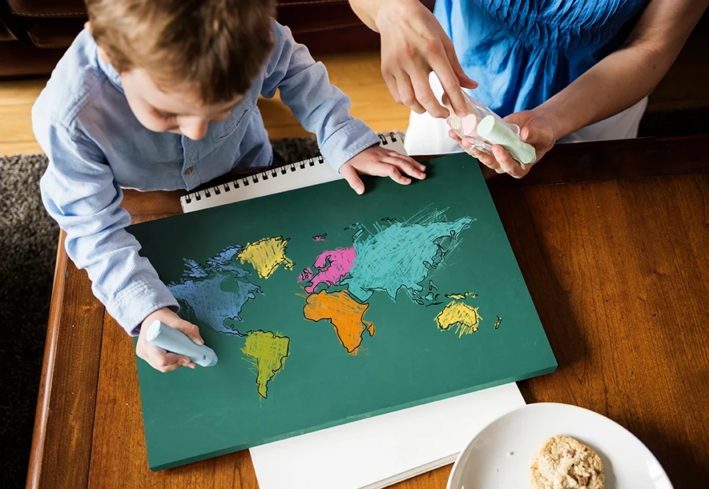
World Map for Kids – How to Choose a Good Map for Learning?
A world map can be a colourful decoration on a child’s wall. It can also become one of the simplest tools for helping them understand how the world is organised.
The difference does not depend on how many animals, landmarks or bright illustrations appear on it.
What matters more is whether the child can actually use the map to find information appropriate for their age.
A good world map for kids should be clear, geographically accurate and suited to the child’s current level of knowledge. Younger children usually benefit from simple maps with clearly visible continents and oceans, while older children can work with countries, borders, capitals and more detailed geographical information.
There is no single perfect map for every child.
The first question should always be:
What will the child use the map for?
What Is the Best World Map for Kids?
The best world map for a child is one that presents information they can actually understand and use. It should be clear, large enough to read and free from unnecessary elements that make countries or continents difficult to find.
A map for a five-year-old does not need to look the same as one designed for a ten-year-old.
Before choosing a map, consider:
- the amount of detail,
- the size and readability of labels,
- how clearly continents and countries are shown,
- whether oceans are labelled,
- the number of additional illustrations,
- geographical accuracy,
- the size and format,
- whether it can be used for different activities.
More information does not always make a map more educational.
Sometimes it simply gives a child more things to look through before they find what they actually need.
What Should You Look for When Choosing a World Map for a Child?
Focus on readability, geographical accuracy, the amount of detail, the child’s age and the purpose of the map.
A simple checklist can help:
| Feature | What to check |
|---|---|
| Readability | Are the names easy to read? |
| Continents | Can they be identified quickly? |
| Countries | Are borders and names visible? |
| Oceans | Are they clearly labelled? |
| Detail | Is there too much information? |
| Illustrations | Do they support or cover the map? |
| Format | Does it suit the way it will be used? |
| Age level | Can the child understand what is shown? |
| Accuracy | Are names and borders up to date? |
Appearance matters too.
An attractive map can encourage a child to look at it.
But design should never interfere with its main function:
showing where places are located.
Should a World Map for Kids Be Colourful?
Colours can make geographical areas easier to distinguish, but they should have a purpose rather than being purely decorative.
Colour can help a child notice:
“This is Africa.”
“This country ends here.”
“This blue area is an ocean.”
Problems appear when a map contains all of the following at once:
- very strong colours,
- dozens of animals,
- landmarks,
- flags,
- vehicles,
- characters,
- additional captions.
A child may remember where the panda illustration is while still being unable to find China.
Illustrations are not necessarily a problem.
They should simply support the map instead of replacing it.
Should a World Map for Kids Show Countries?
If the goal is to learn about individual countries, the map should clearly show national borders and country names. Younger children, however, can begin with a simpler map focused mainly on continents and oceans.
A child who has just started discovering maps does not need to recognise dozens of countries immediately.
They can begin with:
“This is Europe.”
“This is Africa.”
“This is Australia.”
Later:
“Poland is in Europe.”
“Japan is in Asia.”
“Brazil is in South America.”
This creates a useful geographical hierarchy:
world → continent → country → city.
A separate article about continents for kids can explore the next stage in much greater detail.
Should a Kids’ World Map Include Capitals?
Capitals are useful once a child can already recognise countries and is ready for more detailed information. For beginners, too many city names can make a map harder to read.
If a child is only learning to find France, they do not immediately need to identify:
- Paris,
- Lyon,
- Marseille,
- Bordeaux.
Start with:
France.
Then:
France → Paris.
A map showing capitals can therefore be valuable, but it is not essential for every child.
Learning world capitals also has its own clear search and learning intent and is better developed separately.
Is a World Map with Flags Good for Kids?
A map with flags can help children connect a national symbol with a country’s name and location, as long as the flags do not cover important geographical information.
For example:
🇯🇵 → Japan → Asia
🇮🇹 → Italy → Europe
🇧🇷 → Brazil → South America
This links several pieces of information together.
However, if the map contains dozens of large symbols, readability can suffer.
A map with flags works best when flags are actually one of the topics the child is learning.
Political or Physical Map – Which Is Better for Kids?
A political map is generally better for learning countries, borders and capitals. A physical map is more useful for learning about mountains, rivers, deserts and landforms.
These two maps answer different questions.
A political map can help answer:
- Where is Poland?
- Which countries border it?
- Where is Japan?
- How large is Brazil compared with neighbouring countries?
A physical map can show:
- mountain ranges,
- rivers,
- deserts,
- lowlands,
- highlands,
- other natural features.
For children who are beginning to discover countries, a simple political map is usually easier to understand.
That does not make a physical map less valuable.
It simply has a different purpose.
World Map or Globe – Which Is Better for a Child?
A map and a globe are not direct substitutes. A globe better demonstrates the shape of Earth, while a map is usually easier for searching, comparing and completing activities.
A globe helps a child understand something a flat map cannot show as naturally:
Earth is not a rectangle.
You can rotate it.
You can ask:
“What is on the other side?”
“Where is Europe compared with North America?”
A map has different advantages.
It is easier to:
- place on a table,
- hang on a wall,
- compare countries,
- mark locations,
- follow routes,
- use together with activity books.
Ideally, the two tools complement each other.
If you can only choose one for regular work with countries and activities, a map often offers more practical possibilities.
Is a Wall Map Good for Kids?
A wall map can be very useful when it is placed where the child can easily approach it and point to different places.
It should not hang so high that it becomes only a decoration.
A child should be able to walk up to it and say:
“We were here.”
“Where does a kangaroo live?”
“Here is Japan.”
“Where is Italy?”
The map becomes part of everyday life.
If you read about Egypt, find it on the map.
If Spain is mentioned during a sports event, locate it.
If you are planning a trip, show the destination.
These short interactions can build geographical awareness without turning every moment into a formal lesson.
How High Should You Hang a World Map for a Child?
If the child is supposed to use the map actively, place it at a height that allows them to point to locations comfortably.
A map hanging far above the child’s head is mainly:
decoration.
A map they can reach becomes:
a learning tool.
If possible, let them:
- point to countries,
- compare locations,
- add removable markers,
- return to places independently.
Is a Scratch Map Good for Kids?
A scratch map can be a fun way to record visited countries, but it is not always the best map for learning geography.
It can be useful when the main goal is:
“Where have we travelled?”
But if the child needs to answer:
“Where is Japan?”
“Which countries are in Europe?”
“Which countries border Poland?”
a traditional, clearly labelled map may be more useful.
Choose the format according to its purpose rather than simply because it looks entertaining.
Can Children Mark Countries They Have Learned About?
Yes. A map does not need to record only real journeys. It can also show a child’s journey through knowledge.
You can create two types of markers:
I have visited this place
and
I have learned about this place.
The second category might include countries discovered through:
- books,
- activity sheets,
- school,
- documentaries,
- animals,
- family conversations,
- pretend travel games.
This turns a map into a visual record of discovering the world, not only travelling around it.
Are Interactive World Maps Better for Children?
Interactive maps can add sounds, quizzes or additional information, but being interactive does not automatically make a map better for learning geographical orientation.
Interactive features are most useful when they require the child to do something:
“Find this country.”
“Point to the continent.”
“Match the flag.”
They may be less valuable if the child simply presses buttons and listens to information without using it.
A traditional map has one significant advantage:
it does not automatically give the answer.
The child has to:
- search,
- compare,
- locate,
- return to places they have seen before.
Both formats can be useful.
The better choice depends on what the child is expected to do.
Is a Colouring World Map Good for Learning?
A colouring map can help children notice the shapes and locations of geographical areas when colouring is combined with searching and naming.
Instead of saying:
“Colour the map.”
Try:
“Find South America and colour it.”
Then:
“Can you find Brazil?”
Or:
“Which continent is on the other side of the Atlantic Ocean?”
Colouring becomes part of geographical exploration rather than only a creative activity.
Are Illustrated World Maps Good for Kids?
Illustrations can create useful associations with places, but too many pictures can make the actual geography harder to see.
For example:
🦘 → Australia
🗻 → Japan
🐼 → China
These associations can help children begin exploring.
The problem appears when a child can locate the kangaroo but cannot identify Australia itself.
A useful question is:
Would this still work as a map if the illustrations were removed?
If the answer is yes, the illustrations are probably supporting the map.
If not, it may function more as an educational poster.
What World Map Is Best for Preschool Children?
For younger children, choose a simple map with clearly visible continents, oceans and a limited amount of additional information.
At this stage, it is enough to begin understanding:
- where land is,
- where water is,
- that there are different continents,
- that their home country is only one small part of the world.
A few carefully chosen illustrations can help create associations.
The map should still remain easy to read.
What World Map Is Best for School-Age Children?
School-age children can usually work with more detailed maps showing countries, borders, capitals and other geographical information.
The map should allow them to answer questions such as:
“Where is Spain?”
“Which continent is Japan in?”
“Which countries border Poland?”
If answering these questions means searching through dozens of icons and tiny captions, the map may be too crowded.
Is It Worth Having More Than One Map?
Yes, if the maps serve different purposes. There is little value in buying several maps that present exactly the same information.
A useful set might include:
- a simple political world map,
- a globe,
- a physical map for an older child,
- a map that can be coloured or marked.
Each gives the child a different way to look at the same world.
The goal is not to own many educational materials.
It is to provide different ways of understanding geographical space.
How Do You Know If a World Map Is Too Difficult?
Ask the child to complete a few simple tasks. If most of their effort goes into separating information from decoration, the map may be too detailed.
Try:
“Show me Europe.”
“Find Poland.”
“Where is the ocean?”
“Can you find Japan?”
This is not a test.
If the child does not know where Japan is, show them.
Then see whether they can find it again.
That tells you more about the map’s usability than the number of educational features advertised on the packaging.
How Can You Check Whether a Kids’ Map Is Accurate?
An educational map should use current names and geographical information and should not mislead children through excessive simplification.
Check:
- the publisher,
- the publication or update date where available,
- geographical labels,
- national borders,
- the source of the information if provided.
Be especially careful with random printable maps found online.
An attractive illustration does not guarantee geographical accuracy.
For educational materials, design comes second.
The first question is:
Is the information correct?
How Should You Choose a World Map Based on a Learning Goal?
Different learning goals require different types of maps. A map for learning continents does not need the same information as one used for capitals or physical geography.
If the Goal Is Learning Continents
Choose:
- a simple map,
- large clearly separated areas,
- large labels,
- few additional elements.
If the Goal Is Learning Countries
Choose:
- a political map,
- visible national borders,
- readable country names.
If the Goal Is Learning Capitals
Look for:
- a political map,
- clearly marked capital cities,
- easy-to-understand city symbols.
If the Goal Is Physical Geography
Choose:
- a physical map,
- mountains,
- rivers,
- landforms,
- natural features.
If the Goal Is Travel
A map that allows children to mark or track destinations may be useful.
One map does not need to perform every possible function.
Is a Laminated Map Better for Kids?
A laminated map may be more practical if children will frequently touch it, mark places or use it on a table. A standard paper map may be enough if it mainly hangs on a wall.
A laminated map can work well if the child will:
- use suitable erasable markers,
- mark destinations,
- handle the map often,
- work together with siblings.
A paper map can be sufficient when:
- it stays on the wall,
- it is mainly used for pointing,
- it does not need to be moved often.
Durability matters only when it fits the intended use.
Can a Map in an Activity Book Be Enough?
A map in a book or printable activity pack can be very useful for learning about a specific country or completing a focused activity, while a larger world map provides a better overview of global relationships.
A smaller map works well for:
- finding a particular country,
- connecting it to its continent,
- colouring,
- marking a route,
- working with one activity.
A large map makes it easier to notice:
- where continents are relative to one another,
- which countries are nearby,
- approximate distances,
- the overall structure of the world.
The two formats work especially well together.
A child can explore Japan in an activity book and then locate it on a large world map.
This creates the connection:
detail → whole world.
Is a Printable World Map Useful for Kids?
Yes. A printable map can be particularly useful for activities because children can colour, label and mark it without worrying about damaging a permanent wall map.
You can print:
- a world map,
- a continent map,
- a country outline,
- a blank map,
- a map designed for colouring or marking.
You do not need to print everything at once.
One week:
Europe.
Another:
Asia.
Later:
Japan.
This works especially well for thematic learning.
Should a World Map Show Oceans?
Yes. Oceans are a fundamental part of world geography and help children understand how continents are positioned in relation to one another.
Children can gradually notice:
- continents are separated by large areas of water,
- the Atlantic Ocean lies between Europe and the Americas,
- the Pacific Ocean covers a huge part of the world.
They do not need to memorise every ocean name immediately.
But a good world map should not ignore them.
Should a Kids’ Map Show the Equator?
The equator becomes useful when children begin learning about hemispheres, climate and global position.
It can help explain:
“Australia is south of the equator.”
“Poland is in the Northern Hemisphere.”
“The equator crosses part of South America.”
It is not essential for the youngest children.
For older children, it becomes increasingly useful.
Should a World Map Include Compass Directions?
Yes. A simple compass rose or north marker helps children gradually understand direction and location.
Children can learn:
- north,
- south,
- east,
- west.
There is no need to introduce them as a formal lesson immediately.
Use the words naturally:
“Norway is farther north.”
“Japan is east of Poland.”
Over time, geographical directions become part of the language used when exploring maps.
Does a Children’s Map Need a Legend?
If a map uses symbols, colours or markings that need explanation, it should include a clear legend.
A legend teaches an important map-reading skill.
A child sees a star.
They check the legend.
They discover:
“This symbol means capital city.”
They begin to understand that maps communicate information through symbols rather than showing the world exactly as it looks.
Can a Kids’ World Map Be Too Simple?
Yes. Simplifying information is useful, but simplification should not create a misleading picture of the world.
A children’s map can reduce detail.
It should not:
- move countries into incorrect positions,
- show misleading borders,
- distort geographical relationships unnecessarily,
- use illustrations in a way that suggests incorrect locations.
A children’s map does not need to look like a professional atlas.
But it still needs to function as a map.
How Can You Tell Whether a Child Is Actually Using the Map?
Give the child a real question that the map can help answer.
For example:
“Find Europe.”
“Show me Poland.”
“Where is Japan?”
“Which ocean lies between Europe and North America?”
“Which country is next to this one?”
The point is not testing knowledge.
If the child does not know, let the map help them discover the answer.
That is one of the best indicators of a useful map:
the child can use it to find information.
How Can You Use a World Map to Learn About Countries?
Whenever a child learns about a new country, first locate it on the map before moving on to its flag, capital, landmarks or facts.
For Japan, the sequence could be:
- Find the country.
- Identify the continent.
- Look at the flag.
- Learn the capital.
- Discover one interesting fact.
For the United States:
- Find North America.
- Locate the USA.
- Look at neighbouring countries.
- See the flag.
- Explore one or two well-known places.
The map becomes the starting point, not a separate topic.
How Can You Use a World Map Before a Family Trip?
Before travelling, a map can show a child where they are starting, where they are going and how those places relate to each other.
You can point out:
home → country → destination city
Then ask:
“Is the country in Europe?”
“Are we travelling north or south?”
“What countries are nearby?”
There is no need to analyse the entire route.
A simple geographical context is enough.
How Can You Use a World Map After a Trip?
After returning home, locate the destination again and connect it with photos and memories from the journey.
You can add:
- a photo,
- a removable sticker,
- a small flag,
- the date of the trip.
The child begins linking real experience with geographical location.
The country is no longer an abstract shape on a map.
It is somewhere they remember.
Can a World Map Be Useful Even If a Child Does Not Travel?
Absolutely. Maps are just as useful for exploring places a child has never visited and may not visit for many years.
Read about Australia.
Find it.
Learn about an animal that lives there.
Then explore Japan.
Brazil.
The United States.
Egypt.
Each new topic receives a specific place in the world.
Learning geography should never depend on how many countries a family can physically visit.
What Are the Most Common Mistakes When Choosing a World Map for Kids?
The most common mistake is choosing a map because it looks attractive without checking whether it actually supports the child’s learning goal.
Watch out for:
- too many illustrations,
- very small labels,
- excessive detail,
- unclear national borders,
- outdated information,
- placing the map out of the child’s reach,
- treating it only as decoration,
- choosing a format that does not match how it will be used.
The most colourful map is not always the most useful one.
What World Map Does a Child Need to Start Learning Geography?
A beginner usually needs a clear map showing continents, oceans and a simple political division of the world. It does not need to contain every possible geographical detail.
The child should be able to:
- find Europe,
- locate their home country,
- see major oceans,
- find several familiar countries.
More detail can be introduced gradually.
A map should grow in complexity along with the child’s knowledge.
World Map for Kids – Quick Checklist
Before choosing a map, ask:
- Is the geographical information accurate and current?
- Can the child easily identify continents?
- Are the labels readable?
- Is the level of detail suitable for the child?
- Does the map show the information they actually need?
- Do illustrations interfere with geography?
- Are countries and borders clear enough?
- Is the format suitable for the way it will be used?
- Can the child access and use the map independently?
Only then ask:
Do we like how it looks?
A good children’s map can do both.
It can be attractive.
But above all, it should be useful.
Frequently Asked Questions About World Maps for Kids
What Is the Best World Map for a Child?
The best map is clear, geographically accurate and appropriate for the child’s age and learning goal. Younger children usually benefit from simple maps of continents and oceans, while older children can work with countries, borders and capitals.
Is a Political or Physical Map Better for Kids?
A political map is usually better for learning countries, borders and capitals. A physical map is more useful for mountains, rivers and landforms.
Should a World Map for Kids Include Flags?
It can, especially if the child is learning national flags. The flags should not cover country borders or make the map harder to read.
Are Illustrated World Maps Good for Children?
Illustrations can help children create associations with countries, but they should not dominate the map or make geographical information difficult to find.
Is a Scratch Map Good for Learning Geography?
It can be a fun addition for recording visited places, but it may not replace a traditional map for learning countries, borders and geographical position.
Is a Globe Better Than a World Map?
They serve different purposes. A globe better demonstrates the shape of Earth, while a map is easier to use for searching, comparing, marking and activities.
Is a Laminated World Map Worth Buying?
It can be useful if the child will frequently touch, mark or move the map. For a map that mainly hangs on a wall, a paper version may be enough.
Can a Printable World Map Be Educational?
Yes. Printable maps are useful for colouring, labelling, tracing routes and working with specific continents or countries.
Should a Preschooler’s World Map Show Countries?
It can, but it does not have to. For younger children, recognising continents, land and oceans may be more important at first.
Should a World Map Include Capital Cities?
Capitals can be useful for older children, but too many city labels can make a beginner’s map difficult to read.
Where Should You Hang a World Map in a Child’s Room?
Place it where the child can comfortably approach it and point to locations. A map within reach is more likely to become a learning tool rather than simply wall decoration.
How Do You Encourage a Child to Use a World Map?
Use the map whenever a real question appears. Find countries mentioned in books, travel plans, sports, stories, animals or everyday conversations. The simple question “Where is that?” can lead to regular geographical exploration.
Summary
A good world map for kids does not need to contain the largest possible number of flags, illustrations and facts.
Its main job is to help a child find answers.
Where is Europe?
Where is Poland?
Which continent is Japan in?
What lies between Europe and North America?
For younger children, a simpler map is usually better.
Older children can gradually move towards greater detail.
Use political maps for countries and borders.
Use physical maps for mountains and rivers.
A wall map can encourage spontaneous discovery.
A printable map can become an activity.
A globe can show the world from another perspective.
There is no need to search for one map that does absolutely everything.
Choose the map that answers the questions your child is currently asking.
Because one of the most important moments in learning with a map is not when an adult says:
“This is Japan.”
It is when the child asks:
“Where is Japan?”
and knows how to find the answer.
Turn the Map Into a Journey Around the World
A map can be the starting point for discovering an entire country.
Nice Family educational activity books combine maps with national flags, interesting facts, illustrations, colouring and activities.
A child can first find a country on the world map and then explore it in greater detail through individual activities.
This creates a simple learning sequence:
Find it → explore it → remember it.