
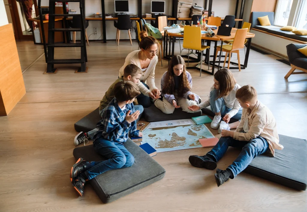
Continents for Kids – How to Learn Them Without Rote Memorization
Europe, Asia, Africa…
For adults, the names of the continents may seem obvious. For a child, however, they can easily become just another list of words to memorize.
It does not have to work that way.
One of the easiest ways to teach continents to kids is to connect each name with its location on a map, its general shape and familiar countries, places or associations. Instead of starting with memorization, help children understand how the world is divided and where each continent is located.
Europe then stops being just a word.
It becomes a real place on the map.
A child discovers that Poland, Italy and Spain are all located there. Then they begin to notice other large parts of the world around it.
This broader view is a useful starting point for learning geography.
What Is a Continent?
A continent is one of the world’s major land areas. Continents help us divide and describe the land on Earth and understand where countries and other geographical features are located.
Young children do not need a complicated geographical definition.
You can start with something simple:
“Earth has several enormous areas of land. We call them continents. Countries are located on these continents.”
Then show the idea on a map.
For example:
world → Europe → Poland → Warsaw
or:
world → Asia → Japan → Tokyo
This helps a child understand the relationship between different geographical concepts instead of learning each name as an isolated fact.
How Many Continents Are There?
In the seven-continent model, the continents are Africa, Antarctica, Asia, Europe, North America, South America and Australia.
They are:
- Africa
- Antarctica
- Asia
- Europe
- North America
- South America
- Australia
However, children may occasionally encounter a different answer.
That does not necessarily mean the source is wrong.
Different educational systems use different continent models. Some combine Europe and Asia as Eurasia, while others treat North and South America as one continent.
This is particularly useful to know when children use educational books, websites, videos or apps produced in different countries.
Rather than creating confusion, it can become an interesting geography lesson:
“People can use different systems to divide the same world.”
For learning purposes, it is usually best to follow the model used in the child’s school or educational materials.
What Are the Seven Continents?
The seven continents are Africa, Antarctica, Asia, Europe, North America, South America and Australia. Instead of learning only their names, children should gradually learn where each one is located.
Let’s look at them individually.
Europe
Europe is the continent where countries such as Poland, France, Italy, Spain and Germany are located.
For a child living in Europe, it is often the easiest place to start.
Begin with something familiar:
“This is where we live.”
Find your country first.
Then zoom out:
“And this larger area is Europe.”
The child can gradually discover other European countries, such as:
- Italy,
- Spain,
- France,
- Germany,
- Norway.
There is no need to learn them all at once.
The first important connection may simply be:
Poland → Europe
Later, that single connection can become the foundation for exploring the entire continent.
Asia
Asia is located east of Europe and is the largest continent by land area.
Instead of beginning with a long list of countries, choose one or two that the child already recognises.
For example:
- Japan,
- China,
- India,
- South Korea.
If a child is interested in Japan, this gives you an immediate starting point.
Find Japan.
Then ask:
“Which continent is Japan in?”
Now the child has a concrete connection:
Japan → Asia
Over time, more countries can be added to the same mental map.
Africa
Africa lies south of Europe and can be recognised on a world map by its distinctive shape and position.
At first, there is no need to learn all of its countries.
Choose a few examples, such as:
- Egypt,
- Kenya,
- Morocco,
- South Africa.
It is also important not to present Africa as if the entire continent had the same landscape, climate, wildlife or culture.
Africa is an enormous and highly diverse continent.
That diversity can itself become part of the learning process as children begin exploring individual countries.
North America
North America lies west of Europe across the Atlantic Ocean and includes countries such as Canada, the United States and Mexico.
Many children may already recognise the United States from movies, books, sports or popular culture.
Use that knowledge:
USA → North America
Then zoom out and find the entire continent.
Later, add Canada and Mexico.
Again, one familiar country can become an anchor for understanding a much larger geographical area.
South America
South America lies south of North America and includes countries such as Brazil, Argentina, Chile, Peru and Colombia.
Brazil can be a useful first reference point because many children have heard of it through football, the Amazon rainforest or other interests.
Start with:
Brazil → South America
Then gradually add:
- Argentina,
- Chile,
- Peru,
- Colombia.
The goal is not to memorize every country immediately.
The first goal is to recognise where South America is on the world map.
Australia
Australia is both the name of a country and, in the seven-continent model used here, the name of a continent.
This can initially be confusing for children.
You can simply explain:
“Australia is a country, and Australia is also the name used for this continent in this model.”
The broader region of Oceania includes many Pacific islands and countries and can be introduced separately as the child’s geographical knowledge develops.
For beginners, the most important task is simply to locate Australia on the world map and recognise its position.
Antarctica
Antarctica is the continent surrounding the South Pole. Unlike continents such as Europe or Asia, it is not divided into countries in the same way.
This makes Antarctica particularly useful for explaining an important distinction:
A continent does not simply mean:
“a group of countries.”
It is a geographical concept.
Find Antarctica on a world map and then compare its location on a globe.
On many flat world maps, children will see it stretched across the bottom.
On a globe, its position around the South Pole becomes much easier to understand.
Why Do Kids Confuse the Continents?
Children are more likely to confuse continents when they learn the names without connecting them to locations, countries or other meaningful reference points.
A list such as:
Europe, Asia, Africa, North America…
is abstract.
Compare it with:
Poland → Europe
Japan → Asia
USA → North America
Brazil → South America
Now each continent has an anchor.
As children discover more countries, they gain more reference points.
That is why one of the first questions should not necessarily be:
“Can you name all seven continents?”
A better question may be:
“Which continent do we live on?”
Then:
“Can you find it on the map?”
How Can You Teach Continents to Kids?
Teach continents gradually: begin with the whole world, locate one continent, connect it with a familiar country and then add new continents over time.
A simple sequence could be:
- Look at the whole world map.
- Find the continent where you live.
- Find your country.
- Choose another continent.
- Find one familiar country there.
- Return to both continents later.
- Gradually add new ones.
There is no need to organise one long lesson called:
“Today we will learn all seven continents.”
Regular short interactions with a map can be much more natural.
Do Kids Need to Learn All Seven Continents at Once?
No. Children can learn continents gradually and revisit earlier ones as new continents are introduced.
For example, begin with a simple contrast:
Europe – this is where we live.
Africa – this is here, south of Europe.
Later, add Asia.
Then North and South America.
Australia and Antarctica can follow.
The pace should depend on the child rather than on the need to complete a list.
The goal is not to recite seven names after one activity.
The goal is for the map to gradually start making sense.
How Can You Use a World Map to Teach Continents?
A world map helps children see the location, general shape and spatial relationships between continents, making it one of the most useful tools for learning them.
Instead of only asking:
“Where is Asia?”
try:
“Find Europe first. What large continent is next to it?”
Or:
“Find Africa. What is north of it?”
Or:
“Can you find North America? Which ocean separates it from Europe?”
These questions encourage children to notice relationships.
They are no longer learning seven separate shapes.
They are beginning to understand how those shapes fit together on the planet.
If you are still choosing a map, see also:
World Map for Kids – How to Choose a Good Map for Learning
Is a Globe Useful for Learning Continents?
Yes. A globe helps children see continents on a three-dimensional model of Earth and understand relationships that can be distorted or less intuitive on a flat map.
Try a simple comparison:
- Find Europe on the map.
- Find Europe on the globe.
- Find Africa on both.
- Rotate the globe and find North America.
- Find Australia.
- Look for Antarctica.
This introduces an important idea:
The world map and globe show the same planet in different ways.
Children do not need to understand map projections yet.
Simply noticing the difference is already useful.
How Can Kids Learn Continents by Shape?
The general shapes of continents can provide useful visual clues, but shape should not be the only method children use to identify them.
Try:
- continent puzzles,
- outline maps,
- cut-out continent shapes,
- matching activities.
Ask:
“Which continent could this be?”
Then place it on a map.
But always reconnect the shape with:
its name + its location.
A child who recognises the outline of Africa but has no idea where Africa belongs on a world map has learned only part of the concept.
Does Colouring Continents Help Kids Learn Them?
Colouring can support learning when children have to find and identify a continent before colouring it.
Instead of:
“Colour all the continents.”
Try:
“Find Africa.”
“Colour it.”
“Now find Europe.”
“Which one is farther north?”
Or:
“Colour South America. Can you find North America above it?”
The important part is not the colouring itself.
It is the geographical thinking happening around the activity.
For more ideas on using colouring as part of learning, see:
Educational Coloring Pages for Kids – How to Use Them for Learning
Can Puzzles Help Kids Learn the Continents?
Yes. World map puzzles can help children notice the shapes and positions of continents, especially when their names are used during the activity.
Instead of silently completing the puzzle, ask:
“Where does Africa go?”
“What is above it?”
“Which continent is next to Europe?”
“Where should Australia go?”
The puzzle becomes a geography activity rather than only a shape-matching exercise.
What Is a Simple Continents Game for Kids?
One of the simplest continent games is to give the child a country, place or clue and ask them to find the correct continent on the map.
For example:
“Find the continent where we live.”
“Which continent is Japan in?”
“Where is Brazil?”
“Find the continent on the other side of the Atlantic Ocean.”
You can also reverse the roles.
Point to a continent and let the child name it.
Then let the child point while you guess.
This small change can make the activity feel less like a quiz.
How Can Kids Connect Countries With Continents?
Connect every new country with its continent from the beginning so children gradually build an organised mental map of the world.
Instead of learning:
“Japan.”
And separately:
“Asia.”
Connect them:
Japan is in Asia.
Do the same with other familiar examples:
Poland → Europe
Egypt → Africa
Canada → North America
Brazil → South America
Australia → Australia
Over time, children begin grouping countries themselves.
When they encounter a new country, they may start asking:
“Which continent is it in?”
That question is a sign that their geographical framework is developing.
How Can You Use a Child’s Interests to Teach Continents?
Connect continents with subjects the child already finds interesting, because familiar topics provide natural starting points for geographical exploration.
If they are interested in:
Japan → find Asia.
Brazilian football → find South America.
New York → find North America.
kangaroos → find Australia.
the pyramids of Egypt → find Africa.
These associations are only starting points.
As the child learns more, show that every continent contains far more diversity than a single animal, landmark, food or country can represent.
Should Kids Learn Continents and Oceans Together?
Continents and oceans can be introduced together because oceans help children understand how different land areas are positioned in relation to one another. However, there is no need to memorize every continent and ocean at the same time.
Begin with simple relationships:
“The Atlantic Ocean is between Europe and the Americas.”
“Look how much water surrounds Australia.”
“Antarctica is surrounded by ocean.”
The child gradually stops seeing a map as a collection of colourful land shapes.
Instead, they begin noticing:
land + water + location + distance.
A separate article about oceans can later develop this topic without overloading the current one.
How Should You Not Teach Continents?
Avoid making memorization and testing the main method of learning. Continents make more sense when children repeatedly see, find and use them in context.
Try to avoid:
- repeatedly asking the child to recite all seven names,
- turning every activity into a test,
- introducing too many countries at once,
- correcting every mistake immediately,
- teaching only from a written list,
- expecting mastery after one session.
If the child confuses Asia and Europe, you do not have to say:
“No, that’s wrong.”
Try:
“Let’s check the map.”
The map becomes the source of the answer.
That is a much more useful habit than guessing until an adult confirms the correct response.
How Long Does It Take for a Child to Learn the Continents?
There is no single correct timeframe. Being able to use the knowledge later is more important than memorizing all seven names as quickly as possible.
One child may remember the names almost immediately.
Another may need many short encounters with the map.
Instead of measuring progress only by asking:
“Can you name all seven continents?”
also ask:
“Can you find Africa?”
“Which continent is Japan in?”
“Where do we live?”
“Can you find South America?”
These questions show whether the child can use what they have learned.
What If a Child Confuses North America and South America?
Show both continents together and focus on their position relative to each other rather than teaching them as two unrelated names.
On the map, show:
North America
↓
Central America
↓
South America
Then add two familiar reference points:
USA → North America
Brazil → South America
Those two countries can become anchors.
Later, add Canada, Mexico, Argentina, Peru and others.
The child gradually builds a richer picture around the original distinction.
What If a Child Confuses Europe and Asia?
Start with a familiar point in Europe, such as the child’s home country, and then show Asia as the enormous region extending farther east.
A globe can be particularly helpful here.
Europe and Asia are part of one continuous landmass, so their division may be less visually obvious to a child than the separation between Africa and South America.
Start with:
“Here is Poland.”
“Poland is in Europe.”
Then move across the map:
“And farther in this direction, we reach Asia.”
There is no need to expect the boundary between the two concepts to feel immediately obvious.