
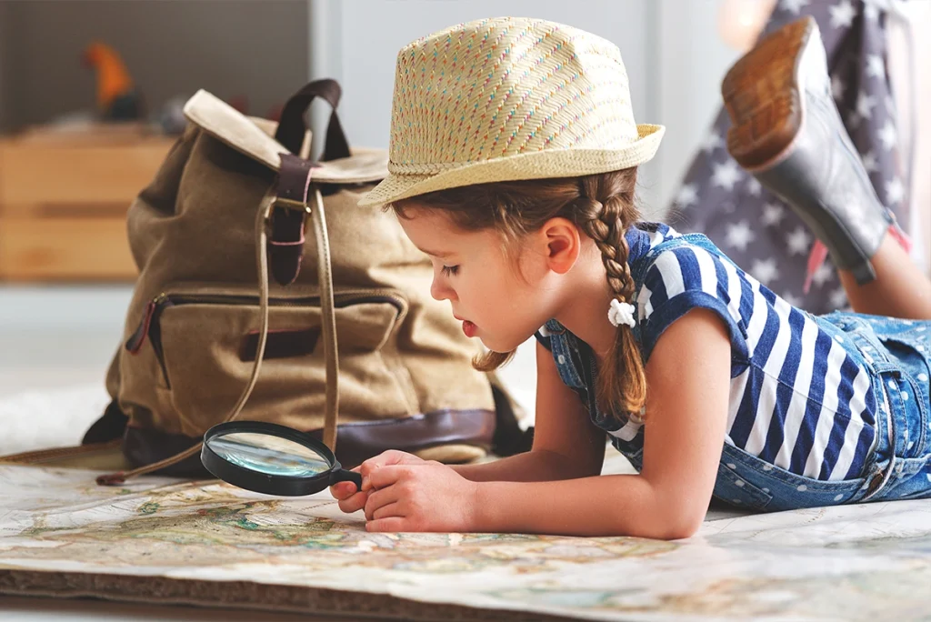
How to Teach Kids to Read a World Map: Fun Map Activities Without Memorising
A world map can look like a giant puzzle to a child. Continents, oceans, hundreds of countries, borders and city names create an image that cannot be understood in a single afternoon.
And there is no need to try.
The best way to teach a child to understand a world map is to start with places they already know and gradually expand the perspective: home, town, country, continent and finally the whole world.
The goal is not to memorise as many names as possible.
What matters more is helping the child understand what a map actually shows and how different places relate to one another.
Only then does it make sense to build knowledge about continents, oceans, countries and directions.
Where should you start when teaching a child to use a world map?
Start by finding a place the child already knows. Their home country, hometown or a recent holiday destination gives them a clear point of reference and helps them understand that a map represents real places.
From an adult perspective, it may seem logical to begin with the seven continents.
For a child, that is not always the easiest starting point.
A much better first question is:
“Where are we on this map?”
Find your country.
Then find your continent.
After that, look for a place where you went on holiday or a country where someone in the family lives.
The child begins to understand a key idea:
a map is not a collection of random shapes – it represents places that really exist.
A useful first exercise is to gradually “zoom out”:
home → town or city → country → continent → Earth.
You can also reverse the order and zoom back in from the whole world to where you live.
This simple activity helps children understand scale much more naturally than learning definitions.
What should a child learn first on a world map?
At the beginning, it is enough for a child to understand the difference between land and water, find their own country and begin recognising continents and oceans. More countries, cities and details can be introduced later.
There is no single correct learning sequence, but a simple progression works well:
- land and water,
- home country,
- home continent,
- other continents,
- major oceans,
- a few familiar countries,
- how countries and continents are positioned relative to one another.
A child does not need to know every name immediately.
The first goal is to understand the overall structure of the world.
They can notice that Europe is next to Asia, Africa lies south of Europe, and the Atlantic Ocean separates Europe from North America.
Once this basic picture is familiar, more detail can be added gradually.
Is a map or a globe better for a child?
A map and a globe serve different purposes. A globe is better for showing the shape of Earth and the relative position of continents, while a map is more convenient for finding countries, cities, borders and routes. Ideally, children should use both.
This is especially useful at the beginning.
A world map is flat even though Earth is spherical. Any flat map therefore has to transform the surface of the planet in some way.
You do not need to explain map projections to a young child.
It is enough to say:
“This is what Earth looks like as a globe, and this is how we show it on a flat map so that it is easier to look at.”
Then find the same places on both.
Your country on the globe → your country on the map.
Africa on the globe → Africa on the map.
The Pacific Ocean on the globe → the Pacific Ocean on the map.
This helps the child understand what the map is actually representing.
How can you teach children the continents?
Continents are easiest to learn gradually through their position, shapes and associations with countries, animals and landscapes. Instead of memorising a list, children should locate each continent on the map.
A common seven-continent model includes:
- Europe,
- Asia,
- Africa,
- North America,
- South America,
- Australia,
- Antarctica.
There is no need to introduce all seven at once.
Start with the continent where the child lives.
Then find the continent where Japan is located. Or where kangaroos live. Later, find Brazil.
Step by step, the map begins to fill in.
Simple comparison questions also help:
- Which continent is the largest?
- Which continent is furthest south?
- Where is Africa in relation to Europe?
- Which continent is your country in?
- Which continents are connected by land?
This way, children do not only learn names. They begin to understand where the continents are in relation to one another.
How can you teach children the oceans?
Oceans are best introduced together with continents because they help children understand what lies between the major land areas of the world.
Start with a simple question:
“What is between Europe and North America?”
Then find the Atlantic Ocean.
Next:
“Which huge ocean lies between Asia and the Americas?”
This immediately connects the ocean’s name with its position.
Five oceans are commonly recognised:
- Pacific Ocean,
- Atlantic Ocean,
- Indian Ocean,
- Southern Ocean,
- Arctic Ocean.
A young child does not need to memorise all five straight away.
What matters more at first is understanding that oceans separate and surround major land areas and cover most of Earth’s surface.
How do you move from continents to countries?
Once a child begins to recognise continents, you can gradually add familiar countries. Start with places the child already has some connection with.
Their own country is the natural first step.
Then you might add:
- Italy,
- Spain,
- France,
- Japan,
- the United States,
- Australia.
The choice should not be random.
If the child has been to Italy, start there. If they are interested in Japan, find Japan. If relatives live in the UK, look for the United Kingdom.
Each new country should have some meaningful connection.
You can also build simple relationships:
“Poland and Spain are both in Europe.”
“Japan is in Asia.”
“To travel from Europe to the United States, you cross the Atlantic Ocean.”
This is how children gradually build their own mental map of the world.
Learn more: “Countries of the World for Kids: Exploring Cultures, Flags and Traditions.”
Should children learn country borders straight away?
No. At the beginning, the general location of a country is more important than memorising its exact borders. Neighbouring countries can be introduced later, once the child feels more comfortable using the map.
A good starting point is the child’s own country.
Ask:
“Can you travel directly from Poland to Germany?”
Then find the shared border.
Next:
“Does Poland share a border with Spain?”
Let the child check the answer on the map.
These kinds of questions help explain what a national border actually means.
Later, you can explore all neighbouring countries or compare countries that share many borders with others.
How can you introduce cardinal directions on a map?
Start with the four basic directions: north, south, east and west. The easiest way to teach them is by comparing the position of familiar places.
Show the direction markers on the map.
Then ask simple questions:
“Is Sweden north or south of Poland?”
“Which direction do you look to find Germany from Poland?”
“What is south of Europe?”
The child does not need to answer correctly every time.
The key idea is that a map shows not only where something is, but also where it is in relation to something else.
This gradually builds map-reading skills.
Read also: “How to Teach Kids Geography Through Play: 10 Fun Ways to Explore the World.”
How can you play with a world map?
The best map activities ask children to search, compare and make simple decisions. Instead of pointing at places for them to memorise, give them tasks where the map helps them find the answer.
The difficulty can easily be adjusted.
Younger children can look for continents and large countries. Older children can work with cities, borders, oceans and routes.
1. Find a place on the map
Start with familiar locations.
“Find Poland.”
“Show me Europe.”
“Where did we go on holiday?”
“Find the country where Paris is located.”
Once the child becomes more confident, reverse the roles. Let them choose a place for the adult to find.
You can also give clues:
“We are looking for a country in Europe. It borders the Mediterranean Sea and looks a bit like a boot.”
The child does not need to know the answer immediately.
The map is there to help them discover it.
2. Play hot and cold on the map
The classic hot-and-cold game can be adapted to teach the position of countries and continents.
One person secretly chooses a country.
The other points to different places on the map.
If they move closer, say “warmer”. If they move away, say “colder”.
For example, the hidden country is Spain.
The child points to Poland.
“Warm.”
Then Sweden.
“Colder.”
Then France.
“Very warm!”
This helps children notice relative location even before they know every country name.
3. Plan a journey with your finger
Planning an imaginary journey helps children see what lies between a starting point and a destination.
Choose two places.
For example:
Poland → Spain.
Trace the route with your finger.
Which countries could you pass through? Is there only one route? Would you need to cross water?
Then choose a more distant destination:
Poland → Japan.
Now the child can see how large Asia is and how much further away Japan is.
You can also discuss transport.
Could you drive there? Would you need a ship? Would flying make more sense?
The goal is not realistic travel planning. It is understanding distance and relative position.
4. Create a family travel map
Marking visited places helps connect the map with the child’s own memories.
On a large map, you can mark:
- home,
- cities you have visited,
- holiday destinations,
- countries you have travelled to,
- places where relatives live,
- future travel ideas.
Use stickers, pins or simple symbols.
For example:
★ – we have been here
♥ – someone we know lives here
? – we would like to visit
The map becomes not only a geography resource but also a record of the child’s own experiences.
5. Match a picture to a place
Matching images with map locations helps children connect abstract map shapes with the real world.
Prepare pictures of things associated with different places, such as:
- kangaroo,
- panda,
- pyramids,
- Eiffel Tower,
- Statue of Liberty,
- Colosseum,
- Mount Fuji.
Ask the child where each picture belongs.
A younger child can place the kangaroo on Australia.
An older child can find France for the Eiffel Tower and then try to locate Paris.
You can gradually increase the level:
continent → country → city.
The same activity works with animals, foods, flags and landscapes.
How can you use a map when exploring one country?
Whenever a child learns about a new country, locate it on the map first. Show not only the country itself, but also its continent, nearby areas, seas or oceans and its position relative to home.
Imagine the child is learning about Japan.
First, find it on the map.
Then ask:
- Which continent is Japan in?
- Is it close to Poland?
- Is Japan made up of islands?
- Which seas or ocean are nearby?
- Where is Tokyo?
- In which direction would you travel from Poland?
Only after that do you move on to culture, food, landmarks or everyday life.
The map gives every new fact a geographical reference point.
The same method works for any country.
6. Play geographical detective
In this game, the child receives clues and uses them to identify a place on the map.
Start with easy clues:
I am a country in Europe.
I look like a boot.
My capital is Rome.
Where am I?
Then make it harder:
I am in Asia.
I am an island country.
My capital is Tokyo.
For older children, use borders and directions:
I am west of Poland.
I share a border with Poland.
My capital is Berlin.
Later, let the child make up clues for the adult.
This requires them not only to find a country, but also to choose information that identifies it.
7. Find the neighbours
Looking for neighbouring countries helps children understand borders and relative position.
Start with your own country.
Find it and see which countries surround it.
Then choose another country.
Ask:
“Do France and Spain share a border?”
“Can you travel directly from Poland to France without crossing another country?”
“Which country lies between France and Spain?”
“Does Japan have land borders?”
The child begins to see countries not as isolated shapes, but as parts of a wider spatial system.
8. Use an unlabeled map
A map without labels can help children practise orientation without turning the activity into a memory test.
Start with a simple map showing only continents.
Ask the child to label Europe, Asia, Africa or North America.
Later, add oceans.
Only then move to maps with country borders.
There is no need to fill in the entire map.
Choose five countries the child has recently learned and try to place their names correctly.
You can also use symbols.
The child can:
- mark their own country,
- circle Europe,
- add a star to a holiday destination,
- mark a place they would like to visit,
- colour continents they already know.
An unlabeled map becomes a working surface, not a test.
9. Make your own map
Creating a simple map helps children understand that maps are simplified representations of real spaces.
Do not start by drawing the whole world.
Begin with something small.
The child can draw a map of:
- their bedroom,
- the house,
- the route to school,
- a playground,
- a garden,
- an imaginary island.
Where is the bed in relation to the door? How can the table be represented? Can every object be drawn at full size?
Then create a legend.
For example, a blue circle can mean a pond, green can represent forest, and a star can mark hidden treasure.
This introduces the idea of symbols and map legends naturally.
Later, return to a real map and look for the symbols used there.
10. Play “what is next to it?”
Questions about the position of one place relative to another help children read maps instead of simply recognising names.
Start with simple questions:
“What is south of Europe?”
“Which ocean is between Europe and North America?”
“Which country is west of Poland?”
Then make them harder:
“Find a country west of Germany.”
“Find an island south of Italy.”
“Which continent is closest to Antarctica?”
The child does not need to know every answer in advance.
That is why the map is there.
The goal is to teach them how to work out an answer from location and clues.
How should map activities be adapted to a child’s age?
The level of difficulty should depend more on how confidently the child already uses a map than on age alone. Younger children can work with large areas and pictures, while older children can gradually move on to countries, borders, directions and more detailed maps.
A simple progression might look like this:
| Stage | Map activities |
|---|---|
| First steps | land and water, home country, continents, animals |
| Next stage | all continents, major oceans, familiar countries |
| More confidence | European countries, neighbours, capitals, directions |
| Older children | routes, distance, scale, coordinates, different map types |
Age should not be treated as a rigid boundary.
Some children become fascinated with map details very early. Others prefer pictures and large areas for longer.
If an activity is too easy, add another clue.
If it is too difficult, zoom out to a larger area again.
Is it worth putting a world map in a child’s room?
A map placed somewhere easily accessible can encourage spontaneous exploration whenever a country, city or place comes up in a book, film or conversation.
It does not have to be used only during planned learning sessions.
If Africa appears in a story, find it.
If someone mentions a holiday in Greece, check where it is.
If Argentina appears during a football match, look for it on the map.
A map can become something the child uses whenever a question comes up.
For younger children, choose a clear design with strong continent outlines and limited detail.
A highly detailed political map can be overwhelming at first.
What kind of world map is best for a child?
A good first world map should be clear, readable and matched to the child’s level. More information does not always make a better learning tool.
Look for:
- clear continent outlines,
- readable labels,
- suitable size,
- limited visual clutter,
- easy identification of the home country,
- marked oceans,
- durable material if the map will be handled often.
An illustrated map with animals or landmarks can work well for younger children.
Older children may prefer a more traditional political map with countries and borders.
Over time, it is also worth showing that there is more than one type of map.
A political map shows countries and borders. A physical map highlights mountains and landforms. A road map serves a different purpose again.
This is an important step in understanding that maps are created for specific uses.
How can you tell if a child understands a map?
A child understands a map not when they can name the most countries, but when they can use it to find information about where places are.
You may notice that the child can:
- find their own country,
- identify their continent,
- locate familiar countries,
- distinguish land from ocean,
- compare the position of two places,
- find a country using clues,
- understand which place is nearer or further away,
- reach for the map independently when they want to check something.
They do not need to know every name.
If they can use the map to find an answer, they have learned something more valuable than another list of countries.
What mistakes should you avoid when teaching children to use a map?
The most common mistake is treating the map as a test board. Children learn faster when the map is used to search, compare and solve simple geographical problems.
Avoid a few common traps.
Starting with a map that is too detailed
A map filled with city names, rivers, borders and tiny labels may be useful for adults, but overwhelming for beginners.
At first, choose one where it is easy to find:
- continents,
- oceans,
- the home country,
- several large countries.
More detail can come later.
Teaching long lists of countries
Knowing a list of country names does not mean a child can use a map.
They may be able to recite several European countries but still not know where to find them.
Connect every name with location.
Not just:
“Spain.”
But:
“Find Spain. Which continent is it in? What is next to it?”
Correcting instead of searching together
If the child does not know where something is, try:
“Let’s find it.”
Instead of:
“No, that’s wrong. It’s here.”
The map should make the child feel that answers can be discovered, even when they are not known immediately.
Moving to capitals and borders too quickly
If a child is still learning to recognise continents, there is no need to introduce every capital or neighbouring country.
Build general orientation first.
Then add detail.
Is a world map enough for learning geography?
A world map is an important tool, but it should not be the only one. Geography becomes much richer when maps are combined with photographs, globes, atlases, books, travel and everyday experiences.
Maps are excellent for showing location.
They cannot show everything.
A photograph reveals a landscape. A globe shows the shape of Earth. An atlas adds detail. An activity book can introduce facts and tasks.
Use the map as a reference point.
Whenever a child learns something new about a country, return to the map.
This keeps facts connected with place.
Are interactive maps and apps useful?
Interactive maps can complement traditional maps, especially when they allow children to zoom in, compare places and explore details. They should not completely replace physical maps.
Digital maps are engaging because they respond to touch and make it easy to change scale.
But there is also a risk that children focus more on tapping than on understanding location.
A good approach is to combine both.
Find the country on a paper map first.
Then explore it in more detail digitally.
Or do it the other way around.
The child learns that different maps can represent the same world in different ways.
How long should a map activity last?
There is no need for long lessons. A few minutes of regular map use can be more useful than an occasional long session.
The easiest approach is to use natural opportunities.
Someone mentions Greece? Find it.
A book mentions the Amazon? Check where it is.
Planning a holiday? Trace the route.
This makes the map part of everyday learning.
How can educational activity books be combined with map learning?
An educational activity book can become a starting point for map work when the country being explored is immediately connected with its continent, neighbouring areas and position relative to home.
If the child is learning about Japan, go beyond facts and colouring.
Also:
- find Japan on the map,
- identify Asia,
- compare its location with your home country,
- notice that it is an island country,
- find Tokyo,
- identify the nearby ocean.
This allows the activity book and the map to support each other.
Explore educational country activity books if you want to combine learning about the world with colouring, tasks and map-based activities.
How can you teach a child to use a map independently?
The key is to gradually let the child take responsibility for finding the answer. Instead of pointing to the location, give clues and allow them to search.
Start with:
“Find Europe.”
Then:
“Find a country west of Poland.”
Later:
“Find a European country that borders Germany and Belgium.”
Over time, the child learns to use several pieces of information at once.
That is real map-reading ability.
The most important rules for learning a world map
A child does not need to memorise the entire map. They should learn how to read it, understand basic spatial relationships and use it to find information.
The most important rules are simple:
- Start with where the child lives.
- Move from small areas to the whole world.
- Introduce continents and oceans first.
- Add countries gradually.
- Use both maps and globes.
- Connect places with the child’s experiences.
- Ask questions that require searching.
- Introduce directions through real examples.
- Use maps with different levels of detail.
- Do not turn the map into a memory test.
Knowing a map well does not mean knowing hundreds of names.
It means being able to look at it and find the information you need.
Frequently Asked Questions
How do I teach my child the world map?
Start with your own country and continent, then gradually introduce other continents, oceans and countries. Focus on teaching the child how to use the map rather than memorising every name.
What age should children start learning maps?
Simple map activities can begin during the preschool years. Younger children can learn land, water and continents, while older children can gradually explore countries, borders and directions.
How can children learn the continents?
Use a large world map or globe and connect each continent with simple associations such as familiar countries, animals and landscapes.
How can children learn the oceans?
Teach oceans in relation to continents. For example, the Atlantic Ocean can be found between Europe and North America.
Is a globe necessary?
No, but it is useful. A globe helps children understand that Earth is spherical and that a flat map is simply one way of representing its surface.
What type of world map is best for children?
A large, clear map with visible continents, oceans and countries works best at the beginning. Too many small labels can make learning harder.
Are unlabeled maps useful?
Yes. They work well for marking continents, oceans and recently learned countries, as long as they are used as activity sheets rather than full-world memory tests.
Should children know every country?
No. It is more important that they can locate familiar countries and understand which continent they belong to and where they are in relation to other places.
How can I teach cardinal directions with a map?
Use practical questions such as “What is north of Poland?” or “Which direction is France from Poland?”
How often should children use a map?
Short, regular use works best. Reach for the map when discussing travel, books, films, sport or countries mentioned in everyday conversation.
Summary
Learning a world map does not have to mean memorising continents, countries and capitals in a fixed order.
What matters more is teaching the child how to use the map.
Start with familiar places, gradually expand the perspective and ask questions that can be answered by looking at the map.
Over time, children begin to understand that countries are not random shapes, oceans are not just blue background, and maps are not simply school posters.
They are tools for organising and understanding the world.
Choose your first country and find it together on the map.
Our educational country activity books combine facts, activities and colouring to help children explore different places. Every journey can begin with a single point on the map and grow from there.